Bunes Beach is located pretty isolated on the western side of Reinefjorden, near Vindstad and Bunesfjorden on the Moskenesøya island, Norway. Next to Kvakvika Beach it is one of the most scenic beaches of the Lofoten. With its tuquoise waters and the white sandy beach it is a must-see location when visiting the Lofoten islands in Northern Norway.
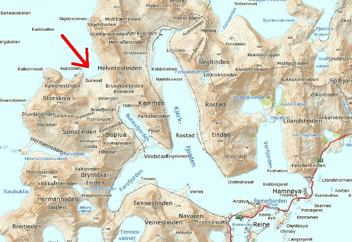
Bunes Map
To get there we catched the last regular ferry of the season from Reine to Vindstad at the end of August at about ten in the morning. If you don't want to camp and spend the night there be sure to check the ferry's current timetable at the harbour to get back to Reine at the same day. During the season they drive back from Vindstad to Reine almost every day at half past three in the afternoon. (But check the timetable there! Ferry Timetable Link)
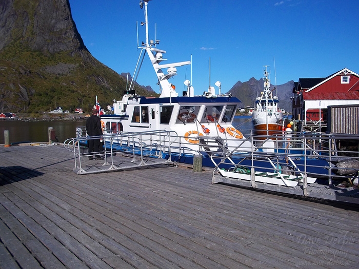
Photo: Ferry in Reine
In mid-summer time during the peaked saison the ferry can be crowded with lots of tourists. On that day there were not that much people taking this last ferry of the season so this was no problem. The crossing of Reinefjorden from Reine to Vindstad takes approximately 25 minutes. As you can see on the photo above we started in Reine with absolutely blue bird skies without any clouds.
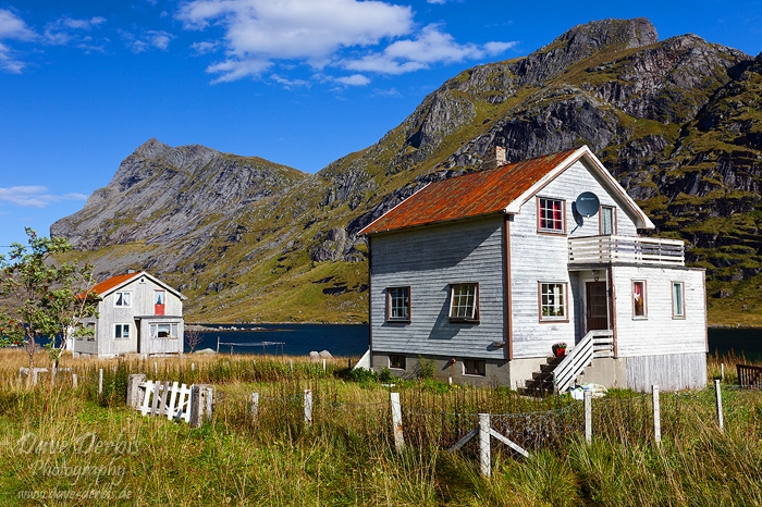
Photo: Hiking Bunes Beach - Houses
When we arrived at the other side of Reinefjorden some clouds started to roll-in from the Norwegian Sea. When you leave the pier in Vindstad just follow the road northwest alongside the fjord. You will see some houses like in the photos above and below.
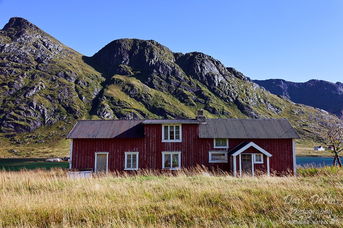
Photo: Hiking Bunes Beach - Red house
The easy road from the pier to the sign in the image below is only about 2 km and not very demanding. The whole route is more of a walk than a serious hike so it is practical for families with children.
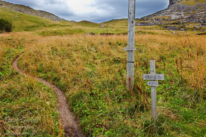
Photo: Hiking Bunes Beach - Sign
When you see this sign turn left and follow the path to the top of the pass. Be sure to measure how long you’ll need to get back to catch the ferry on time. (approximately 1–1.5 hours in each direction, 2–3 hours total)
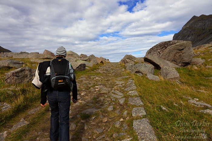
Photo: Hiking Bunes Beach - Path
This section of the trail was build by nuns some hundred years ago. At this point you have almost reached the top of the ridge and can enjoy the view over Bunes Beach. It is larger than it first appears. From the end of the trail to the water is around 650 meters, while the beach is about 750 meters across.
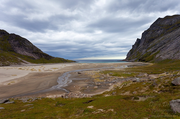
Photo: Hiking Bunes Beach - Viewpoint
This is the view from the top of Einangen over Bunes Beach with Buneset, Ausodden and the 602m high, glacially carved cliffs of Helvetestinden to the right. You may have noticed that the sky is already completely covered by clouds. From blue bird skies to completely overcast it only took about 15 minutes.
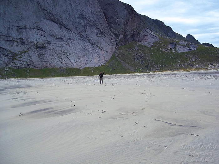
Photo: Hiking Bunes Beach - White Sand
This is me, somewhere in the middle of the beach.
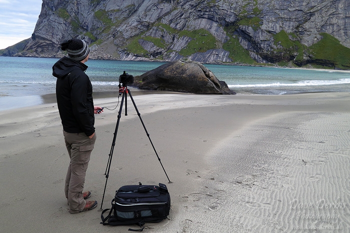
Photo: Hiking Bunes Beach - Taking Photos
Since the light was pretty flat I decided to try a few long exposures with solid nd filters and remote release on the tripod.
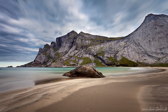
Photo: Bunes Beach - Prints Available
This is the result. A classic s-curve leading the viewer through the image along the beach to Helvetestinden with the incoming clouds on the upper left corner keeping the viewers eye inside the frame.
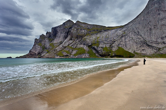
Photo: Bunes Person - Prints Available
Here you see Kirsti standing at the shore, enjoying the view and hoping that I stop taking photos and follow her - sooner or later.
Photo: Bunes Rorbuer - Prints Available
The only rorbuer of the whole bay. Until a few years ago an old women (90+) used to live there in the summer time. It was her birthing house and has neither running water nor electricity but obviously it has quite an awesome view and offers a lot of quietness.
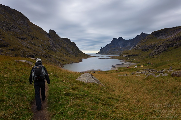
Photo: Hiking Bunes Beach - View towards Bunesfjorden
After spending some hours at the beach and in the wind we headed back to Vindstad to catch the ferry back to Reine. This is the view over Bunesfjorden towars Vindstad and Reinefjorden.
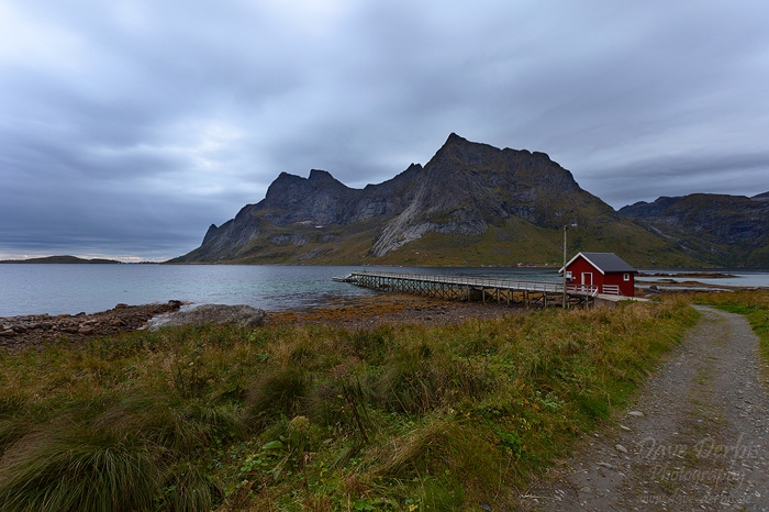
Photo: Hiking Bunes Beach - Vindstad Pier
We arrived back at the pier with some extra time to stroll around and take some photos.
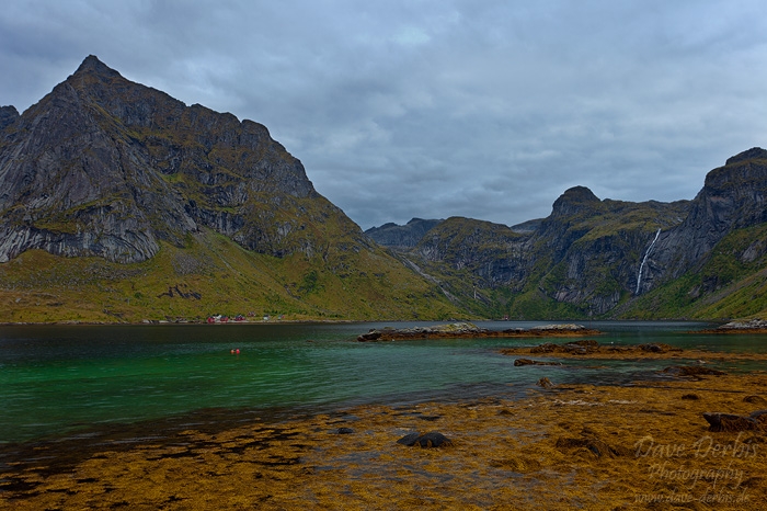
Photo: Hiking Bunes Beach - Forsfjorden
Down at the shore of Forsfjorden I took some photos with seaweed in the foreground and the massive peak of Tennestinden (690m) and the waterfall from Litlforsvatnet in the background.
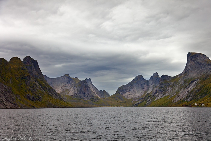
Photo: Kjerkfjorden - Prints Available
This is Kjerkfjorden with Kråkhammertinden (713m) in the background. To the right you see Rostadtindan (697m) and to the left Pantaliatinden (408m).
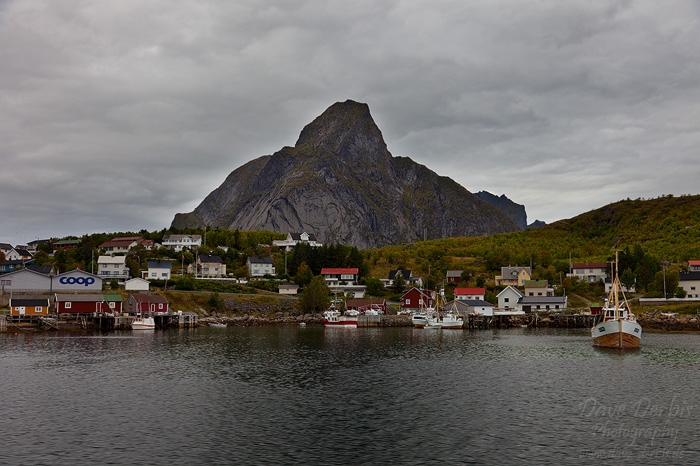
Photo: Hiking Bunes Beach - Olstinden
I took this last photo during our passage over Reinefjorden back to Reine. Here you see some houses and boats of Reine with Olstinden (675m) towering in the background.
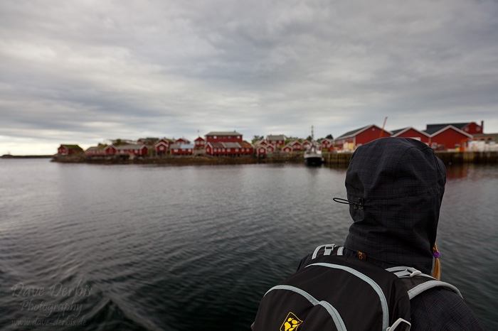
Photo: Hiking Bunes Beach - Reine Harbour
All the red rorbuers, huts and houses are a beautiful sight when coming back to Reine.
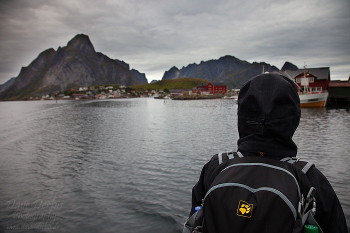
Photo: Hiking Bunes Beach - Reinevågen
One last look back and then the ferry arrived at the pier in Reine.
I hope this hiking report was helpful for you in case you plan to go there on your own. Feel free to leave a comment. Take care!
By the way I have some other hiking reports like Kvalvika Beach, Reinebringen and Tjeldbergtinden in the pipeline for the upcoming weeks - so stay tuned.
Permalink: www.dave-derbis.de/article/hiking-bunes-beach/
