Kvalvika is located on the northern side of the Moskenesøya island. It is one of the most scenic beaches on the Lofoten. With its tuquoise waters and the golden sandy beach it is a must-see location when visiting the Lofoten islands in Northern Norway. You will find it quite isolated between some massive vertical cliffs and only accessable by foot for fit hikers. The surrounding mountains rise up more than 500 meter straight from the beach. The beach is an incredibly beautiful and quite a unique view to enjoy.
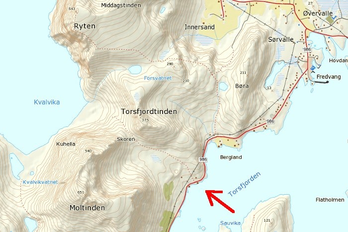
Kvalvika Map
To get there follow the E10 and pass the twin-bridges towards Fredvang. There you head south towards Krystadt. After approximately three kilometers you will see a parking area for about eight cars on the left side. The start of the trail is right on the other side of the road. It cannot be overlooked, I think. The red arrow on the map above marks the parking area and start of the trail.
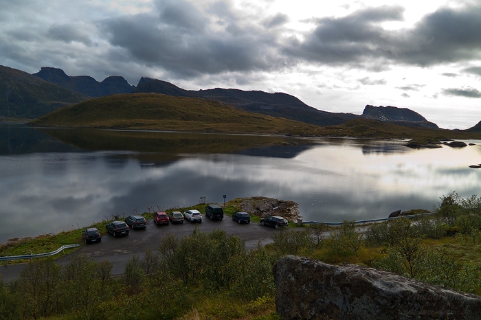
Photo: Hiking Kvalvika - The Start
This was our first hike on the arctic islands, it has been raining heavily the days before and we were not sure how steep and exhausting it would be, so we were pretty excited how things would turn out when hitting the trail that day.
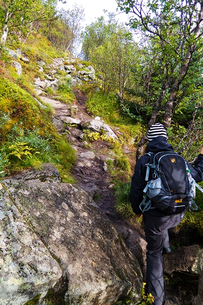
Photo: Hiking Kvalvika -Forest Section
Right from the beginning the trail goes gently uphill through this birch forest. Due to the rain during the last days the path was quite boggy and slippery.
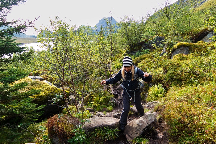
Photo: Hiking Kvalvika -The Trail
The first 20 minutes or so the trail meanders through the bushes and over those huge rocks and constantly uphill.
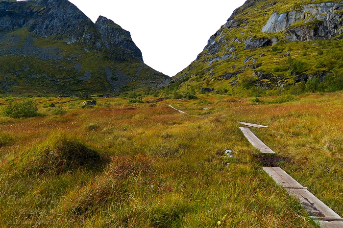
Photo: Hiking Kvalvika -Planks
When you have passed the trees, the trail continues on those planks. This section of the trail below the center of the pass is like a huge moor- or swamp area. Waterproof hiking shoes are highly recommended.
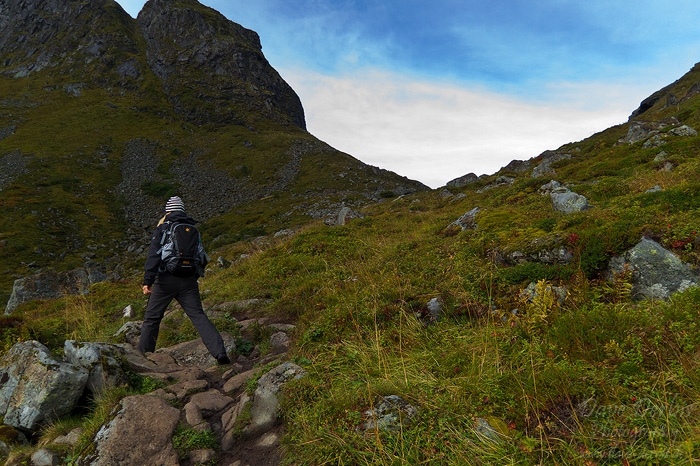
Photo: Hiking Kvalvika - Summit
The path then gets steeper and leads towards Skoren, the windy center between Torsfjordtinden and Moltinen. On this last part of the ascent it gets less muddy and the trail becomes a mix of stones and moss-like grass but it is all not too demanding for an average trained hiker.
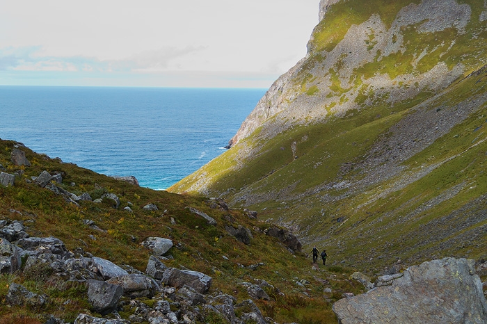
Photo: Hiking Kvalvika -The Descent
After about an hour or so we reached the top of the pass. I think you can do it way faster when you do not take regular breaks for taking photos or soaking in the beautiful landscapes around you. But why hurry.
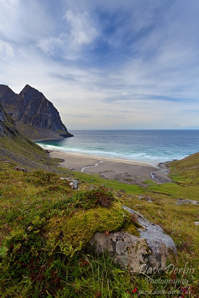
Photo: Kvalvika Beach - Prints Available
When you have finished to enjoy the view from the top of the pass you can begin the descent to the beach. After another 15 - 20 minutes or so you will have this view down to the beach where we have paused again so I could take a few photos from there.
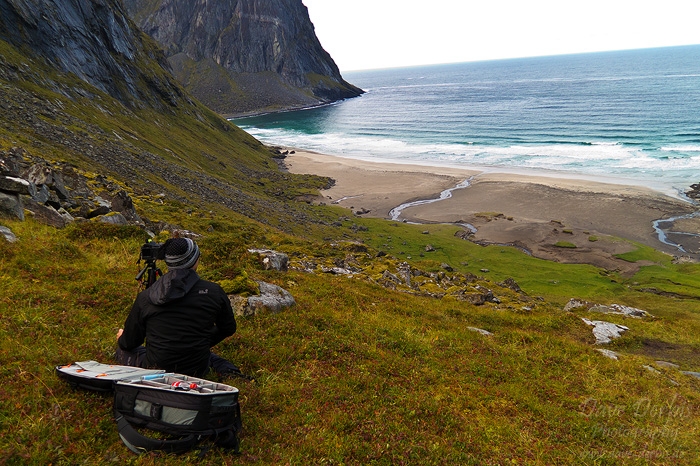
Photo: Hiking Kvalvika - Shooting
That's me with the camera, tripod and my new travel-hiking photo backpack, enjoying the view and composing some photos.
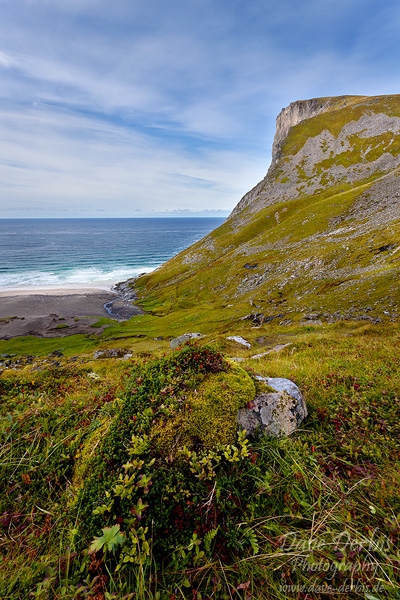
Photo: Ryten - Prints Available
This is the view to the north side of the beach where you see Ryten with its 543 meter rising straight out of the ocean.
The rest of the descent can be pretty steep and rocky from time to time. Once you arrived down at the beach and took your time there you can continue and do a round trip via Ågotvatnet which will also lead you back to the E10 - or you go back the same way. We did the latter.
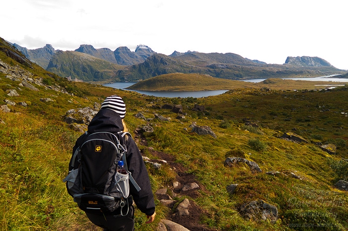
Photo: Hiking Kvalvika - View towards Blåfjellkammen
This is the view towards Blåfjellkammen over Torsfjorden after passing the top of the pass on the way back.
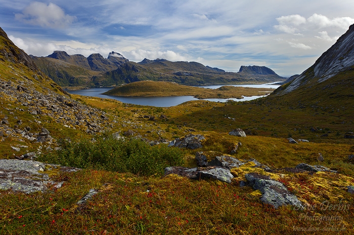
Photo: Skoren - Prints Available
After climbing up the pass on our way back to the car we took another photo break and I created this photo (above) on Skoren looking towards the penisula of Moberget.
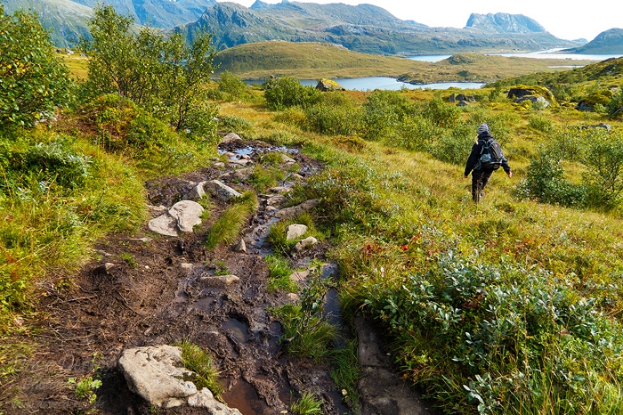
Photo: Hiking Kvalvika - Muddy Section
We somehow managed to hike the rest of the descent without any photo breaks. oO
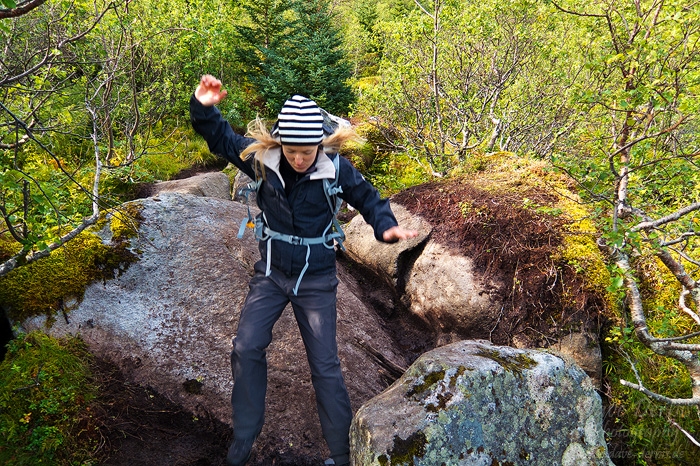
Photo: Hiking Kvalvika - Last Jump
A few last courageous jumps later we returned safely at the parking area with some beautiful memories, impressions and photos.
I hope this hiking report was helpful for you in case you plan to go there on your own. Feel free to leave a comment. Take care!
By the way I have some other hiking reports like Bunes Beach, Reinebringen and Tjeldbergtinden in the pipeline for the upcoming weeks - so stay tuned.
Permalink: www.dave-derbis.de/article/hiking-kvalvika-beach/
